Playa wetlands
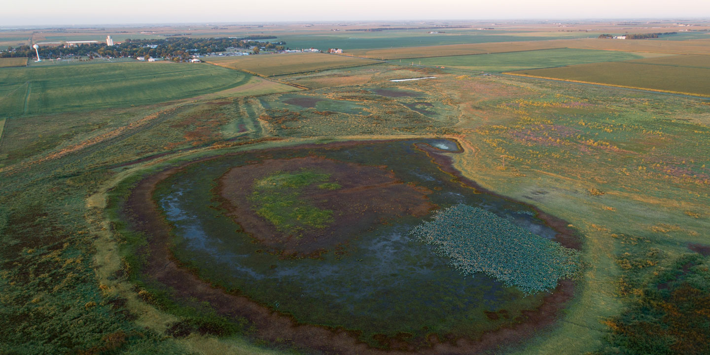
Across Nebraska, several areas are home to scattered playa wetlands — mostly circular, rain-filled basins. The most well-known of these playa systems is the Rainwater Basin; others include the Central Table playas, Southwest playas, and Todd Valley playas.
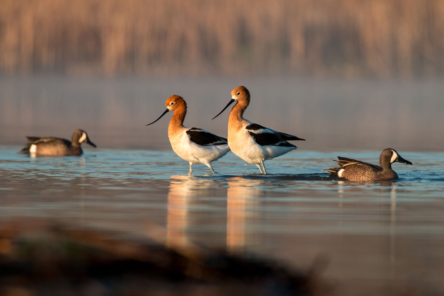
These wetlands provide important benefits to wildlife, attracting different species at different times of year, while also supporting people, improving water quality and minimizing flooding. Several of these systems are listed as areas of greatest continental significance, which means they are vital to migrating waterfowl and shorebirds and threatened or endangered species.
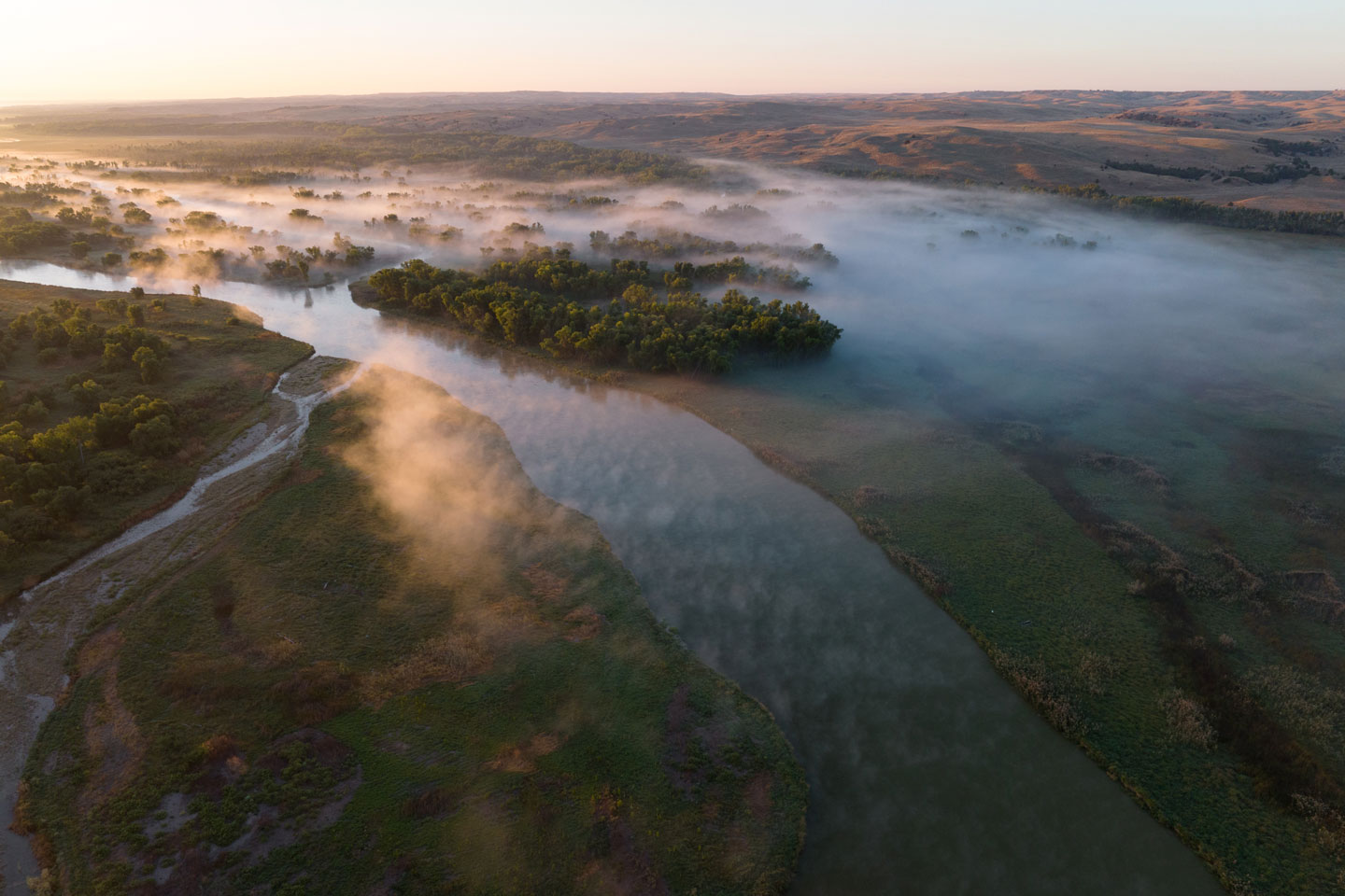
In Nebraska, playas have formed where wind has scoured out a depression on the landscape. While playas aren’t fed by groundwater, they do recharge it as water seeps underground. Over thousands of years, this movement downward has created a clay layer in the soil that ponds water at the surface when wet. These wetlands are continuously changing over the course of a year, generally ponding water in the spring and completely drying out during the heat of summer.
Many of these wetlands have been destroyed or highly altered, and those that remain face continued threats, including conversion to cropland, watershed alterations and invasive plants. But these playas provide continentally important habitat to migratory birds and habitat for a wide variety of other plants and animals. They also support recreational activities, such as waterfowl hunting, kayaking and wildlife watching.
Watch our playa wetlands film
Follow Nebraska Game and Parks and the Platte Basin Timelapse crew to learn about Nebraska’s playas. See how playas benefit wildlife species in Nebraska and beyond. Hear from the people who are working to conserve what’s left of these highly altered ecosystems.
This documentary was produced in collaboration with the Platte Basin Timelapse project at the University of Nebraska-Lincoln by Ethan Freese. Find additional videos, interactive maps, recorded bird sounds, photo galleries of the plants and animals that depend on these wetlands, and a behind-the-scenes look at the making of this documentary in the playa wetlands storymap.
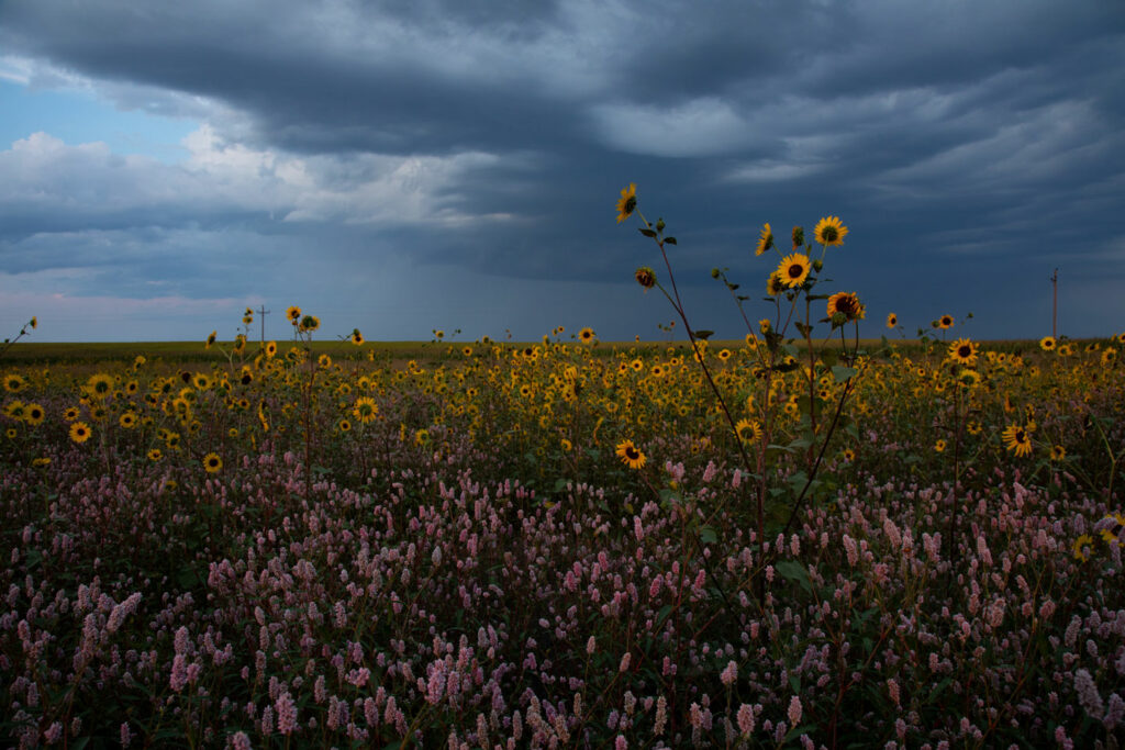
Sunflowers and smartweed blooming in a southwest playa. Photo by Ethan Freese.
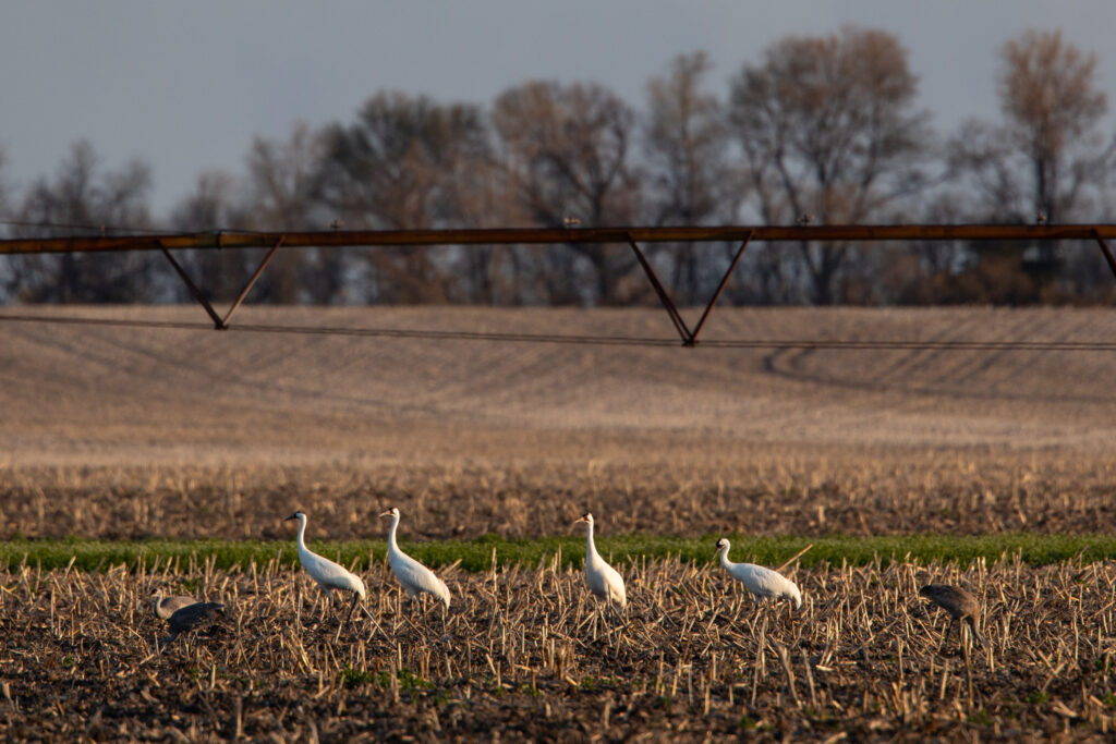
Whooping cranes and sandhill cranes feeding in a cropfield in the Rainwater Basin. Photo by Ethan Freese, PBT.
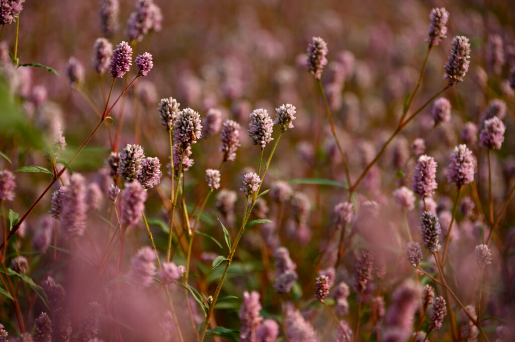
Smartweed blooming in a southwest playa. Photo by Ethan Freese, PBT.
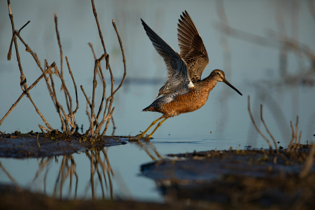
A dowitcher takes flight at North Lake Basin Wildlife Management Area in Nebraska. Photo by Ethan Freese, PBT
Well-known playa systems
Rainwater Basin
Found in southcentral Nebraska, the Rainwater Basin includes abundant clay-bottomed wetlands across nearly 6,200 square miles in 21 counties. These wetlands vary in size from less than 1 acre to more than 1,000 acres. Though they occupy only 1% of the landscape, they have an outsized duty to support millions of birds — especially during spring migration.
More than 250 bird species have been documented using the Rainwater Basin, which for many is their stopping ground on the migratory path. Millions of birds — including the endangered whooping cranes — depend on these wetlands for their survival. Read more about important role the Rainwater Basins play to migrating birds.
These wetlands recharge groundwater, minimize flooding, reduce water pollutants and trap sediments. They also support recreation, such as hunting and bird watching, and diverse plants that provide habitat for wildlife, including ring-necked pheasants.
At one time, these wetlands are estimated to have covered more than 204,000 acres; less than 17% remain.
The Rainwater Basin wetlands have been identified as one of nine areas in the U.S. of critical concern for wetland losses. Conversion to cropland, watershed alterations and invasive plants all threaten the remaining wetlands. Despite that, while the Rainwater Basin landscape is highly altered, the wetlands still provide many benefits, and the altered ones are being restored in many places.
Central Table Playas
These temporary, seasonally flooded wetlands formed on loess-soil plateaus where the surrounding land is cut by drainage from streams and rivers. They receive their water from runoff, and most cover fewer than 5 acres. They are predominantly within the Central Loess Hills Biologically Unique Landscape.
Endangered whooping cranes visit during migration, and the wetlands also provide habitat for other migrating waterbirds.
Of the 6,300 historically documented Central Table playas, 3,470 remain and function at some capacity — either water stills ponds or water-loving plants grow there. In some locations, these wetlands have been modified, turned into concentration pits or drained by ditches. In others, terraces or diversions have been built, which has altered the hydrology of the watershed and reduced the amount of water entering the wetlands. In still others, because they are seasonal, they are farmed as conditions allow. Erosion from surrounding land can carry sediment into the wetlands, threatening those that remain.
Southwest Playas
The playa wetlands of southwest Nebraska are freshwater wetlands formed in clay-lined depressions on the landscape. They receive water from runoff, and most cover fewer than 5 acres. They are temporary, seasonally flooded wetlands, which dry early enough in the growing season to be farmed in most years.
These wetlands provide important habitat for migrating waterfowl, shorebirds and ring-necked pheasants. They are especially important to wildlife in the dry High Plains region of the United States where wetlands often are scarce. The North American Waterfowl Management Plan lists portions of the Southwest Playa complex as an area of greatest continental significance to North American ducks, geese, and swans.
Because the area receives little rainfall each year, fewer of these wetlands have been drained than in other playa wetland complexes as most dry up naturally each year. However, in some locations, the installation of agricultural terraces has reduced the amount of water entering the wetlands, changing the hydrology of the watershed. At the same time, these terraces reduce the amount of eroded soil entering the wetlands — a good thing — as soil erosion and sediment deposition is the biggest threat to playa wetlands.
Todd Valley
The Todd Valley wetland complex is split into two regions. The southern region is in an ancient valley of the Platte River, partially filled with sand and fine, windblown loess soils. The region to the north is on an ancient floodplain terrace between the Platte River and Shell Creek and along Logan Creek.
The wetlands were formed in clay-lined depressions, are mostly freshwater, receive their water from runoff, and are seasonally and temporarily flooded.
Todd Valley wetlands provide benefits similar to the Rainwater Basin and support more than 26 waterfowl species, 24 shorebird species and 13 waterbird species.
Research suggests many of the wetlands here have been altered or eliminated by concentration pits, draining and road ditches, tile lines or agricultural drainage wells.